|
The summit of Mount San Jacinto stands 10,804 feet above sea level. It is the second tallest mountain in southern California and the highest point in San Jacinto Range. This was our destination for the 2001 post SIGGRAPH trip. We would drive to Palm Springs and then take the Aerial Tramway to the Mountain Station at 8,516. From there, it's a 12 mile round trip hike to the top of the mountain at 10,804 feet. |
Some members of the group had been present on the previous hike up San Jacinto in 1995 and others had heard the stories of the trip that later became known as a Death March. That time, the tramway was closed, and the group took a more challenging route up, which involved 5,000 feet elevation gain. This time around, Marc carefully verified that the tram was open, so the climb would only be a moderate 2,300 feet.
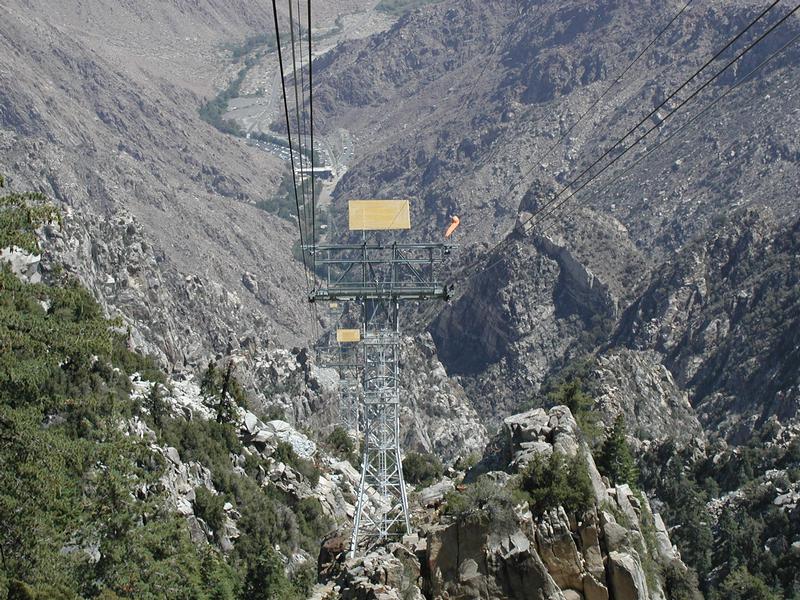 |
At 11:15 the tram arrived, and we took a spectacular 12 minute ride to the San Jacinto Mountain Station. We spent about an hour looking at the views of the Mojave desert and the mountains, eating lunch and acclimating to the altitude. In general, going from sea level to 10,000 in the space of several hours is not recommended, but we were hoping to be fast enough to get off the mountain before the onset of altitude sickness. |
At 12:45, we started the hike. The trail goes through some beautiful pine forest along Round Valley, then climbs through forest and chapparal to Wellman Divide, and then switchbacks more steeply to a point right below the summit, where it's a boulder scramble to the top. We were planning to reach the summit in about 2.5 hours.
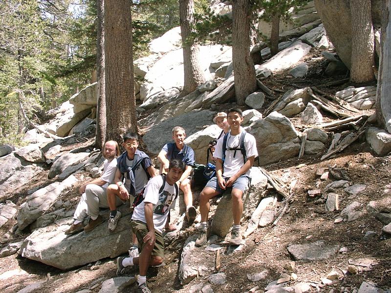 |
Taking a break by the side of the trail. Left to right: Phil, Li-Yi, Pradeep (kneeling), Marc, Natasha, Ren. |
 |
As people were settling into comfortable hiking pace, we split into
three groups. In front, Pradeep, Ren, Li-Yi and Brad were setting the pace.
Pat, Marc, Francois, Philipp, Marcus and I were in the middle, sometimes
splitting into smaller groups and then regrouping again. James and Erika
were the sweep.
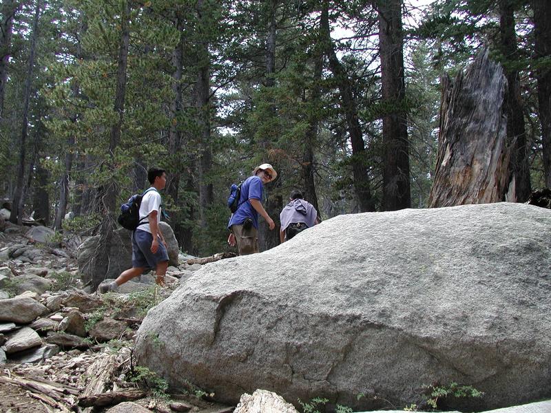
On the left, Ren, Brad and Li-Yi (back to the camera) are hiking up some switchbacks. |
As we were approaching the summit, the thin air was starting to catch up with some of the hikers. On the switchbacks above Wellman Divide, Marc and I caught up with Brad, who got separated from the group in front. He was hiking slowly up the mountain, looking tired but determined.
"I was feeling really hypoxic, and I was having tunnel vision. My hands were going numb because not enough blood was reaching them. I was trying to maintain the fastest pace I could without passing out." -Brad
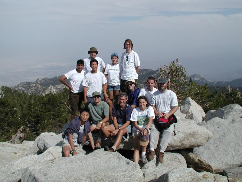 |
Triumphant picture on the summit.
Sitting, left to right: Li-Yi, Pat, Marc (front), Brad (back), Natasha (front), Marcus (back), Philipp. Standing: Pradeep, Ren (front), Francois (back), Erika, James. |
There were two options for the return trip: back along the same trail or an off-trail route along the ridge from San Jacinto to Cornell Peak. The group split up, Marc, Philipp, Ren, Francois and I went along the ridge, and the rest started back along the trail.
 |
The off-trail detour followed the narrow boulder-covered ridge line
from San Jacinto to Cornell Peak, and then down to Mountain Station. Finding
the way through the boulders often proved tricky, and the group had to
backtrack several times, looking for the safest route. Ren turned out to
be an amazing route finder, frequently climbing to high points to look
the easiest route.
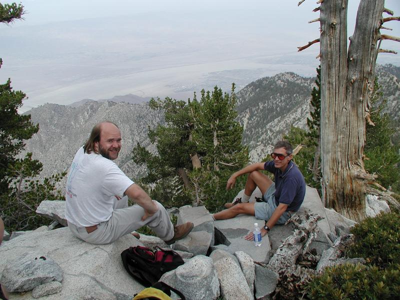
On the left, Philipp and Marc are taking a break on the ridge. |
As we slowly made our way through the boulders, the legs of those wearing shorts were continually assaulted by scratchy chapparal and low tree branches. At one point, I got in a fight with a fallen tree, which resulted in several large scrapes on my legs.
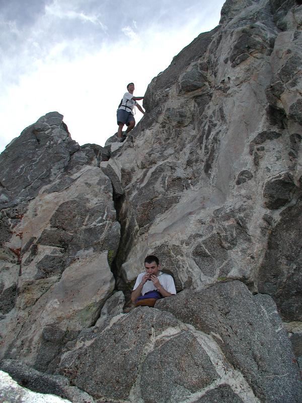 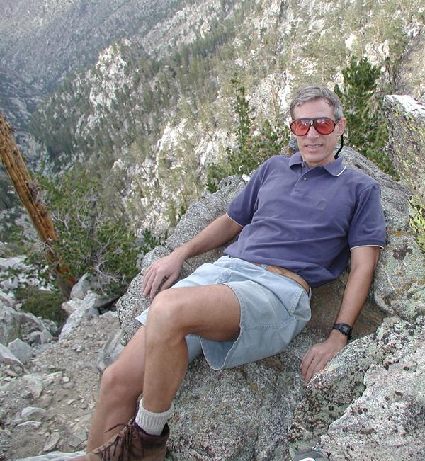 |
Slowly, we reached the base of Cornell Peak and climbed the final steep section to a point below the summit (getting to the summit itself requires ropes). On the left, Ren (above) and Francois are resting before descending from the peak. On the right, Marc is lying on a ledge above a rather sheer cliff. |
After descending from Cornell Peak, the rest of the hike was supposed to be uneventful, but the mountain did not want to let go that easily. Climbing over a boulder, Marc ran head-first into a low-hanging branch, which put a 2 cm long gash above his forehead. For a few minutes the cut bled heavily, blood streaming down Marc's face before he stopped it with direct pressure. A little later I tripped over a rock and faceplanted into the dirt, adding more scrapes to my legs and inhaling large amounts of dust. At around 7pm the exhausted off-trail group arrived to mountain station, where most of the other hikers were waiting.
After feeling fine all the way to the top, Erika suddenly felt very nauseous as she descended from the summit boulders. "I was throwing up every 50 steps, and could not keep down any water." Slowly, James and Erika were hiking down, with Erika finally feeling better as the air got thicker. At that point, however, James was the one feeling ill, suffering from severe dehydration because he was saving all their water for Erika.
Brad's tunnel vision had cleared on the way down, and he was feeling fine until he came to the Mountain Station. As he sat down to rest, he developed a splitting headache. Thinking that the cause was probably dehydration, Brad drank almost a gallon of water within the space of an hour.
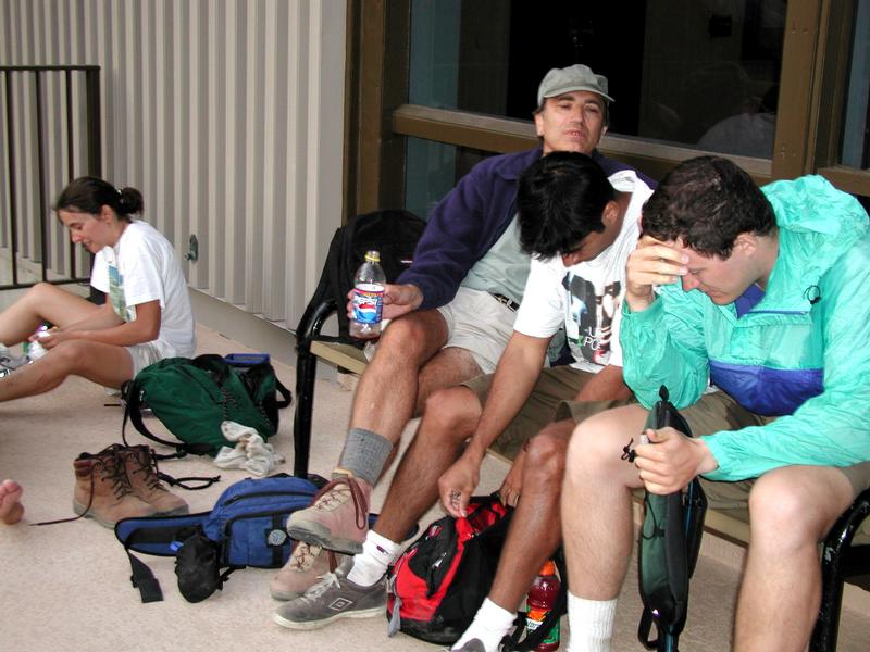 |
At the Mountain Station, waiting for James and Erika to arrive. Brad (on the right) is suffering from a nasty headache, as Pat looks on concerned. Pradeep is looking for his radio to talk to James and Erika who are still on the trail. In the background, I am trying to clean blood off my legs. |
"I was a living physics experiment. My stomach contracted at lower altitude, and there was no place for all that water to go. It just wouldn't fit anymore."
So out it went. Before the car could be stopped, Brad projectile vomited water out of his nose and mouth. Fortunately for everyone, it was just water, so no harm was done.
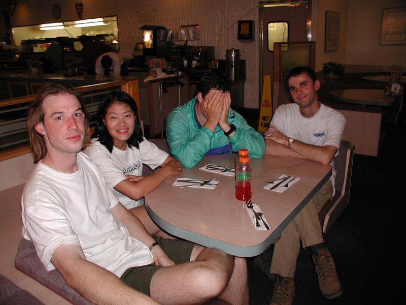  |
We finally ended up an Denny's for the late dinner. On the left is the sick table. From left to right are James, Erika, Brad, and Francois (who wasn't actually sick). At the other table are Marcus, Pradeep, Ren, and Marc, who is holding a paper towel against his head to prevent his newly reopened head wound from bleeding and scaring the other customers. At dinner, Brad announced "When I get back, I'm going straight to sleep so that nothing else can go wrong today." |
After dinner, only the drive to LA remained. Half the group made it to LA without incident. But, unfortunately for Brad, more could go wrong, and it did. Sometime after midnight, seven miles from downtown LA, when the end of this long day was in sight, the van Brad was in blew a tire. After trying to reach roadside assistance for Dollar Rent a Car in vain (booo!), the group called AAA, who towed them to a safe place and replaced the tire. Only then, did the weary hikers manage to get to their beds.
This was definitely an adventure to remember! And of course it was a worthy sequel to the first Death March. Stay tuned for Death March III at SIGGRAPH 2005.
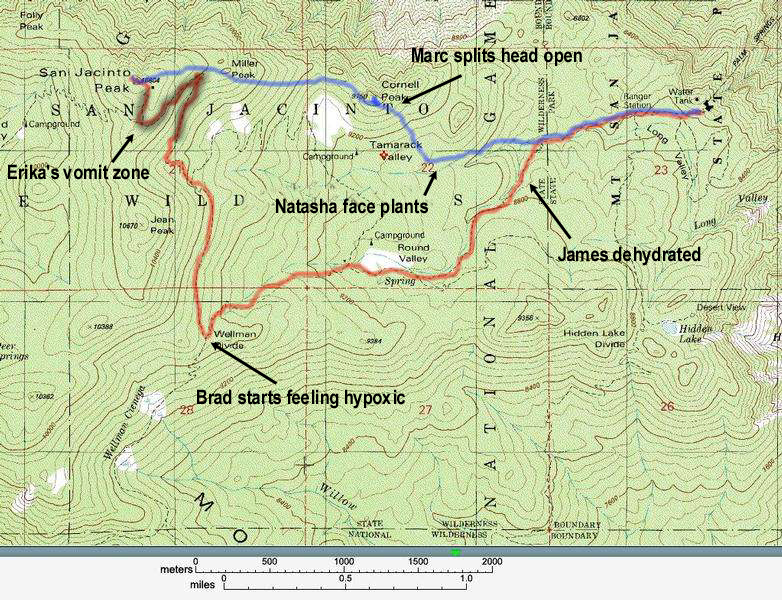
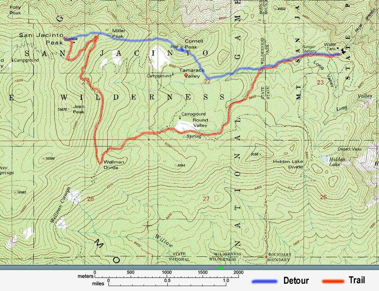
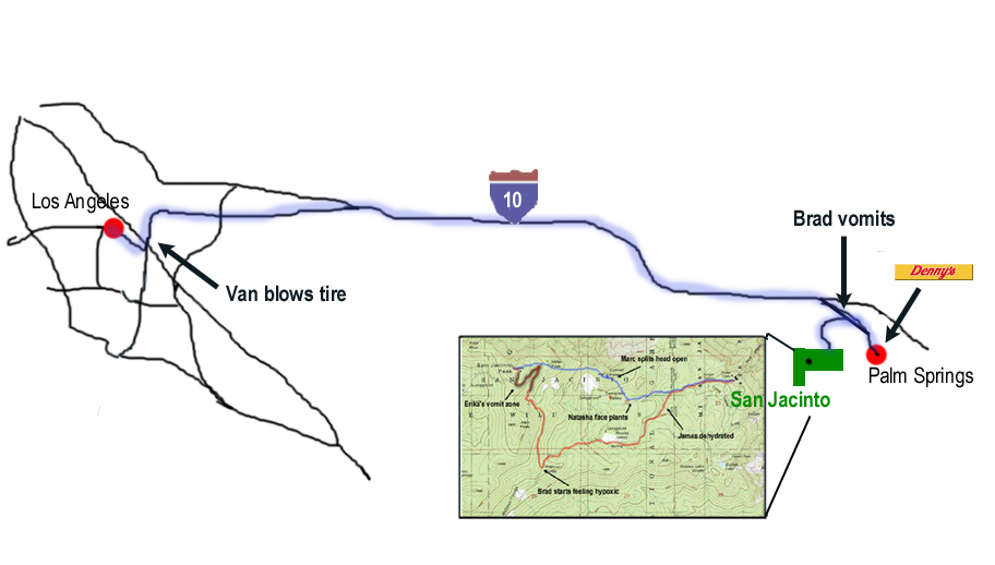 Maps showing locations of various casualties.
Here are more pictures from the hike, taken by Brad Johanson
and me.
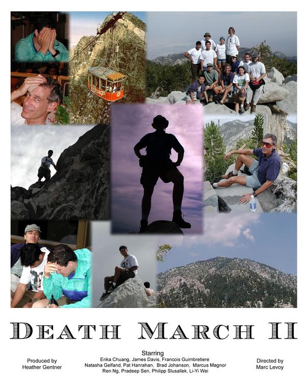
And here is a movie poster
that we made for Death March II.